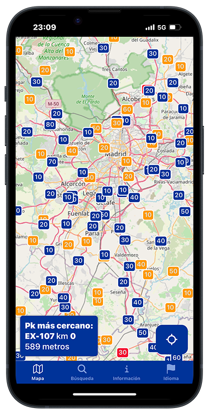
Facilita tu localización identificando tu punto kilométrico más cercano
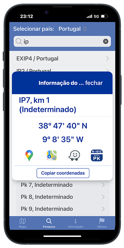
O encuentra de forma rápida y eficaz la ubicación de un punto kilométrico


Obtén las coordenadas de tu ubicación y la carretera y el
kilómetro más cercano.
Si trabajas para los servicios de emergencias o en un servicio de asistencia en
carretera, podrás obtener indicaciones precisas para acudir al punto donde se te necesita.


Si tienes un accidente o eres testigo de uno esta es la forma más rápida de informar a los equipos de primera respuesta de tu ubicación.
Busca un punto kilométrico y obtén enlaces a las principales aplicaciones de navegación.
También puedes copiar las coordenadas del punto kilométrico para utilizarlo en cualquier otra aplicación de navegación.
Localizador de puntos kilométricos
No nos gustan los anuncios ni las cuentas de usuarios para recoger datos. Los únicos datos que
recogemos
son datos estadísticos anónimos de Google para detectar y corregir errores.
No recogemos
ninguna información de usuario. Puedes utilizar la aplicación
sin registrarte.
Las suscripciones se realizan a través de App Store y de Play Store
Esta aplicación ha sido creada para ayudar a los equipos de primera respuesta (ambulancias,
policía, bomberos...),
de forma que puedan localizar de manera rápida y efectiva el lugar donde se necesita su
asitencia.
En origen surgió
para resolver el problema que se encontraban las tripulaciones de helicópteros sanitarios a la
hora de acudir a una llamada
de socorro en una carretera, de la que solo se tenían el nombre de la carretera y el punto
kilométrico.
¿Necesitas un servidor web para acceder desde un ordenador? ¿Quieres una app privada para los
dispositivos
de tu empresa o servicio? Contacta con nosotros y cuéntanos tus necesidades.
Puedes
hacerlo escribiéndo a info@buscapk.es
Esta App agradece el esfuerzo y colaboración de los usuarios gracias a los cuales podemos ampliar y corregir nuestra base de datos.